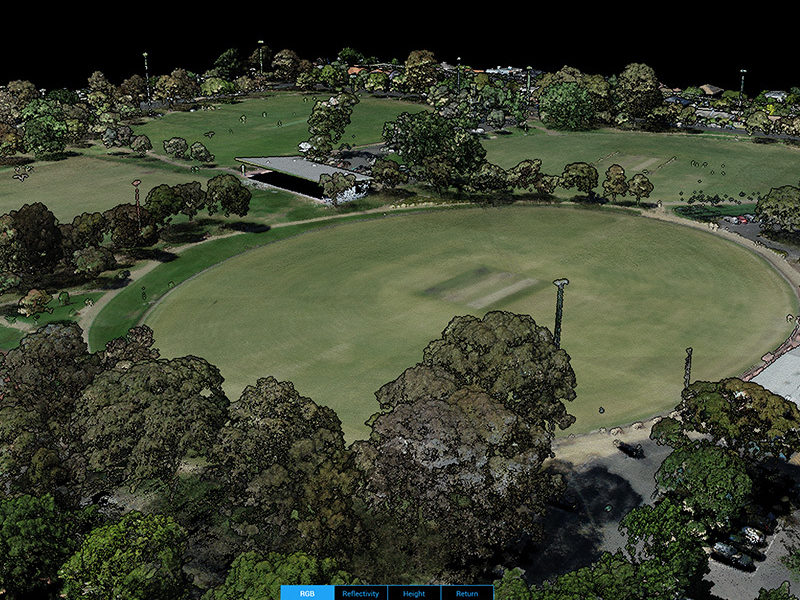
Feature & Level Survey
A feature and level survey is required for design and planning approval of any type of building or infrastructure development. It provides land topographic information and important existing site features for building and drainage design carried out by Architects, Structural Engineers, and Civil Engineers. A feature survey often includes the following information:
- Contours of the land, either in RL or AHD
- Existing manmade features on site, including buildings, retaining walls, fence, drains, utility services, and details of direct neighbouring properties
- Site vegetation cover including locations, canopy span, and height of trees
Civiltest provides cost effective feature and level survey service by using a combination of traditional surveying equipment, RTK GPS, and drone technology. Both efficiency and accuracy are embedded in our workflow.
Specialised Capability
Civiltest have a range of specialised testing equipment and licenses:
- Total Station and RTK GPS
- DJI M300 RTK with L1 LiDAR Payload
- DJI Phantom 4 RTK
- Remote pilot license (RePL)
- Remotely piloted aircraft operator's certificate (ReOC)
Testing and Consulting
- Provide cost effective topographic survey solutions for large sites and sites with difficult terrains and inaccessible areas using our state of art DJI M300 RTK and L1 LiDAR Payload
- 3D coloured point clouds created directly from aerial LiDAR scan and 20MP RGB camera
- 3D site reconstruction using both LiDAR generated point clouds and photogrammetry
- Construction site monitoring and progress tracking with visual timelines and high-resolution aerial images
- Earthwork monitoring including stockpile analysis and cut and fill volume analysis
More Testing and Consulting Services
- Coastal erosion monitoring and slope stability analysis
- Safer assert inspection, digitisation (3D modelling), and tracking

Featured projects
- Carrum Downs Telstra Telecommunication compound - CARRUM DOWNS
- Cranbourne North Telstra Telecommunication compound - CRANBOURNE NORTH
- Fawkner Train Station Bike Parkiteer - FAWKNER
- Burwood East Primary School - BURWOOD
- Stonington Mansion - MALVERN
- Albion Train Station Retaining Wall - ALBION
Find out more about Civiltest's Feature and Level Survey testing services for your next civil engineering project...
Find out more